Posts

My Christmas Eve Walk (route included): A Circular Through Spennymoor Woods and back via Tudhoe Mill Nature Reserve
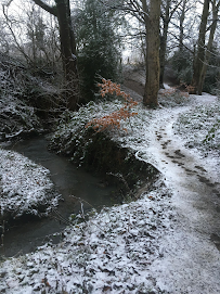
Image
  The Durham coalfields defined a way of life for generations. Once a hub of industrial activity, the towering and intimidating heavy machinery was visible for miles around. Not anymore. Mining has, unquestionably, left its mark on the landscape. The scars are still visible to those who look. Many former railway lines which serviced the mines are now in use as walking and cycling paths. Many towns and villages only came into existence to house the miners and their families. But the mines themselves have all but disappeared, save for those preserved as museums, such as Killhope; and those which, though disused, have been left exposed to time.   This walk takes in several former Co Durham mines: Merrington Colliery (Spennymoor Pit), an old shaft in Burton Woods and Tudhoe Mill Drift Mine. Merrington Colliery has been replaced by Burton Woods housing estate, which is passed by at (2). The nearby shaft in Burton Woods (the actual wood), needs some finding. It is off the main tra...

History Walk: Murders and Mines - The Brass Family Killings and The Dean and Chapter Colliery

Image
  I have been reading about the Brass family murders which took place in 1683 in Kirk Merrington. Andrew Mills, a servant to the Brass family who occupied a nearby farm, killed the Brass family children when their parents were on vacation. They met their ends brutally; their parents returning home to find their lifeless bodies mutilated by Mills’ axe. Mills claimed that the devil had possessed him to carry out the act; a defence which bought him little sympathy. Even if Mills was instructed by the devil, so the prevailing thinking went, he must have let the devil into his heart in the first place. Mills was convicted of murder and placed in a cage on top of a gibbet, near to what is now a Costa Coffee takeaway (until recently the Thinford Inn), on the A688. There are conflicting reports about how he died. He was hanged, that’s for sure. But it has been claimed that he was already dead by this point. The children’s grave, old and battered, still stands in the churchyard at St. John’...

Along the lines 1: The Auckland Way

Image
  The Spennymoor to Byers Green section of the railway line was opened in 1841. It was part of the Clarence Railway Company’s “Byers Green Railway.” Initially, the train transported coal and serviced Port Clarence in Teesside. The route between Byers Green and Bishop Auckland opened in 1885, after which the line was opened up to passengers. The line closed in 1939. The line from Bishop Auckland to Spennymoor is now a path of 4.3 miles, frequented regularly by walkers and cyclists, designated as The Auckland Way. It begins – if travelled in a southernly direction – just in front of Rosa Street School in Spennymoor. This starting point hosts one of the Norman Cornish information points. These information points were set up to commemorate the various places around Spennymoor which Cornish either painted, or to which he had some kind of connection, and form the Norman Cornish trail. This is the old part of Spennymoor, as you can see from the architecture of some of the buildings, suc...

Spennymoor - Along the Farmer's Track

Image
  I’m back in Spennymoor. I'm Only here for two weeks over the festive period. But I intend to fit a few walks in. This walk is special to me. It is not my favourite, nor one I’d especially recommend. It is, however, the one trodden by these feet more than any other. How did it come to acquire this record? The uninteresting answer: its proximity. From my childhood home, in the village of Middlestone Moor, just south of Spennymoor, it is the obvious choice for someone wanting a relatively short expedition from their doorstep. It is the closest place, by foot, from my council estate, to something resembling the countryside. Ideal if you want to take the dog for a walk or go for a short jog. I usually refer to this route as “the lines”. But although it runs alongside the former railway line that is now the Auckland Way, I don’t think it was ever a railway track. It provides access to Bishop’s Close Farm and cottages – hence its other name, the farmer’s track. I’ve also heard people ca...

Crook O'Lune

Image
  When it comes to Lancaster and its surrounding area, there is perhaps no better view than the Crook O’Lune. It has all you want from a walking destination; beauty, wildlife, literary and artistic associations and a rich history. It offers something for everyone. For the keen hiker, there is plenty of walking territory along the meandering Lune. Cyclists are keen visitors, since the spot is located alongside a stretch of the Lancashire cycle way. It is also an ideal location to sit and have a picnic whilst admiring one of the best views in the county. In this post, I will provide some background to this iconic location and describe some of the walks around it. The Crook O’Lune is situated in between the villages of Caton and Halton. Entering via Caton, you will cross a fairly narrow bridge crossing the Lune, which runs adjacent to the cycle way, before shortly turning into the car park. The main part of the car park is often full, especially at the weekend, though there is an ov...

Back in Lancaster and some thoughts on lockdown

You may recall my intention to write a series of posts on the railway paths of my hometown. Alas, a hectic schedule back at university put the dampener on that. I returned to university late September. This term is busier than usual, being the final year of my PhD. And I also have several part time positions contributing to my workload. But I am lucky. Many have suffered severe financial hardship as a result of this pandemic. If anything, the frantic pace of my schedule has provided a welcome distraction from what would otherwise be a fairly solitary situation. And more importantly, none of my loved ones have been afflicted by the virus, and for this, I can only be thankful.  This no doubt paints too rosy-a-picture of my personal experience throughout the pandemic. I have unquestionably struggled psychologically with being stuck indoors so much. When the first lockdown began, a post was doing the rounds on Facebook, lambasting those who complained about the government mandate to ...

A Blencathra Circular (three Wainwrights)

Image
  In this post. I recount a walk I undertook at the end of August. The walk takes in three Wainwrights, Souther Fell, Bowscale Fell, and the main attraction, the mighty Blencathra. I won’t be providing a highly detailed description of the route; there are enough of these available online. Aside from taking in three Wainwrights, this route is also notable for its descent down Sharp Edge – the aptly named ridge which slopes down Blencathra. Be warned, this is not for the faint hearted. A good head for heights is a pre-requisite. And this route should not be attempted in poor visibility or in wet or icy conditions. As far as Lakeland goes, it is an accident hotspot. That said, if visibility and weather are good, and you are up to the job, sharp edge is an enthralling conquest, with splendid views of Scales Tarn below. Our walk begins just off the A66, in Mungrisdale; a quiet but charming village, surrounded by peaks. On weekends, parking can be difficult. I parked on the roadside ca...